By Robert B. Case, PhD, PE
 Considering all the history just a few miles away on Duke of Gloucester Street, the New Town district is literally the “new” kid on the block. Located near the James City County/City of Williamsburg line, along Monticello Avenue between Route 199 and Ironbound Road, New Town, is a 365-acre example of a ‘New Urbanism’ community. “New Urbanism” is a planning and development approach that incorporates homes, offices, retail and restaurants all within easy walking distance.
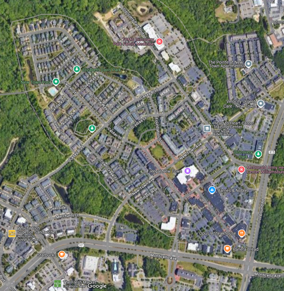
That “easy walking distance” is achieved through dedicated infrastructure. Within the New Town area there are five miles of multi-use paths for pedestrians, cyclists, etc. that provide transportation and connect the area to nearby James City County and Williamsburg area amenities (see list below). Except for one short section of cycle track for two-way bike traffic on the pavement of Monticello Ave near Williamsburg Shopping Center—the New Town path network is comprised of 8’ or 10’ wide asphalt or concrete paths. (Aerial photo of the New Town area, right)
- Settlers Market (shopping)
- Williamsburg/JCC Courthouse
- Berkeley Middle School
- New Town (mixed use development)
- Midtown Row (mixed use development)
- College of William & Mary
- Carriage Heights (neighborhood)
- Chambrel (neighborhood)
- Eastern State Hospital
- James City County Rec Center
- Martin Family Stadium (W&M)
- James Blair Middle School
- Longhill Woods (neighborhood)
| 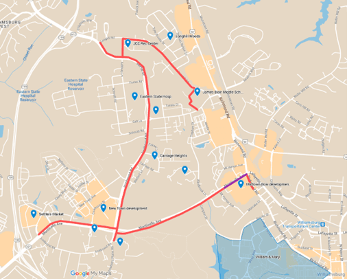 Map of the pathway network in and connecting to the New Town district in James City County/City of Williamsburg. Map of the pathway network in and connecting to the New Town district in James City County/City of Williamsburg. |
Pedestrians and alternative transportation users can expect a diverse experience along the New Town path network. For the most part, the paths run along nearby arterial roadways (see list of roadways and example photos below). However, one portion of the DePue Drive path deviates slightly through the woods, and the Longhill Road path runs behind James Blair Middle School.
While segments pass through wood areas and near a school zone, the New Town area path network can be found next to arterial roadways in the area such as: - Monticello Avenue
- Ironbound Road
- Richmond Road
- Longhill Road
- DePue Drive
| 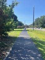
The Longhill Road path runs behind James Blair Middle School. | 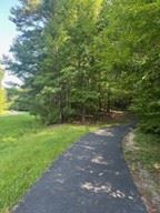
The DePue Drive path deviates slightly through the woods. |
The New Town Area path network is located adjacent to Trail757, as shown in the map below. The proposed Trail757 will eventually run from Jamestown through Williamsburg, Newport News, and York County, ending at Fort Monroe in Hampton. Together, the New Town Area path network and Trail757 will provide New Town residents access to the aforementioned communities, and Trail757 users will have access to retail shopping and restaurants in the New Town area.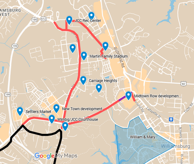 New Town Area Path Network (red and purple lines, existing) and Trail757 (black line, proposed)